Eclipse
Mariners' Museum, Uncurated Search Results
Type: Schooner
Year: 1874
Builder:
Location:
These records are found in the online catalog of The Mariners’ Museum and Park in Newport News, Virginia. Uncurated search results are presented to give researchers and interested readers an idea of whether the museum’s archives contain information about this vessel and whether it may be worthwhile to visit the museum’s catalog search page for further investigation. Uncurated results may be inaccurate or incomplete.
Search mode: Exact Name. Search phrase(s): "Eclipse". Results returned: 48. Results displayed in this table: 48.
Use these buttons to send uncurated search results to your own app or text document for further research. First, check the box for any row, or click "Select All" then uncheck any rows. Then click "Show Selections". You can then copy your selections from the text box and past them into your app.
| Fetch? | Row ID | Media | Date | Vessel | Place | Related Places | Inscription/Marks | Subject | Notes | Archive Number |
|---|---|---|---|---|---|---|---|---|---|---|
| 1 | 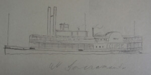 | ECLIPSE | CL22735 | |||||||
| 2 | No image URL. | Eclipse | P0001.011/01-0855 | |||||||
| 3 | 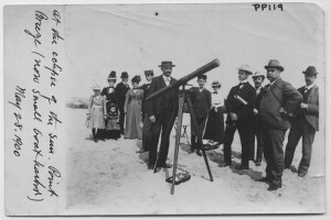 | 1900/05/28 | WRITTEN ON PHOTOGRAPH: AT THE ECLIPSE OF THE SUN. POINT BREEZE (NOW SMALL GOAT HARBOR) MAY28, 1900 WRITTEN ON VERS0: MR. ORCUTT ?, MR. POST ? PROMINENT IN FOREGROUND | SOLAR ECLIPSE | P0001.016/01-#PP0119 | |||||
| 4 | No image URL. | United States Naval Observatory. | Solar eclipses–1929. | plates, map. | LB70709 | |||||
| 5 | No image URL. | United States Naval Observatory. | Solar eclipses–1930. | plates. | LB70708 | |||||
| 6 | No image URL. | Longitude.; Solar eclipses–1936. | Longitude by H.O.208 and the eclipse. | LB50670 | ||||||
| 7 | No image URL. | United States. Navy | "Presents the American version of the Conference [on the limitation or armament]" p. vi. | LB15431 | ||||||
| 8 | 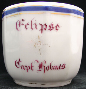 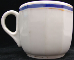 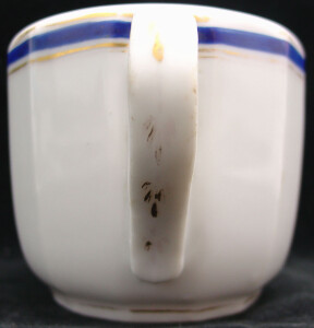 | INVENTORY: One (1) saucer. One component part. NOTES: Notes made in the China File by Nola Hill - work done in the '40's or early 50's per Harold Sniffen, 12/7/81... ECLIPSE Capt Holmes (Mississippi River Boat) Sun in center Ironstone Border gold leaf Cup & Saucer (See also FN 111 plate) INVENTORY: FN 111 | CL5260 | |||||||
| 9 | 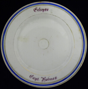 | SHORT DESCRIPTION: White plate with a blue and gold striped border. The center has a golden sun with a face. | CL5261 | |||||||
| 10 | No image URL. | United States Naval Observatory. Nautical Almanac Office. American ephemeris and nautical almanac. Supplement ; 1936. | Solar eclipses–1936 | Total eclipse of the sun, June 19, 1936 __ __issued by the Nautical Almanac Office, United States Naval Observatory, under the authority of the Secretary of the Navy | LB19859 | |||||
| 11 | No image URL. | Astronomical clocks–Great Britain.; Eclipses. | Proposal for the eclipse mechanism on the Wallingford clock. | LB80894 | ||||||
| 12 | No image URL. | Tankers. | SS Eclipse for Coastwise and Middle East Trade. | LB50664 | ||||||
| 13 | No image URL. | Escape from internment on the yacht ECLIPSE: 1915. | LB50665 | |||||||
| 14 | No image URL. | Conway's history of the ship | Warships–History–20th century. | The Eclipse of the big gun : __the warship, 1906-45 __editor, Robert Gardiner ; consultant editor, David K. Brown | LB32732 | |||||
| 15 | No image URL. | Corson of Eclipse and Crittenden, Nansemond County, Virginia and related families of Wilber Gene Corson. | LB88163 | |||||||
| 16 | No image URL. | River binds us : a story told by the people of Crittenden, Eclipse, and Hobson . | LB93371 | |||||||
| 17 | No image URL. | Mount Olympus (Amphibious force flagship : AGC-8). | Contains black-and-white photographs. | MS0817/01-18.138 | ||||||
| 18 | No image URL. | Proceedings of the United States National Museum, 0096-3801 ; 81, no. 2931, art. 8 | Fishes–Niuafoou Island (Tonga); Blenniidae–Tonga–Niuafo'ou.; Snake eels–Niuafoou Island (Tonga); Xenocongridae–Tonga–Niuafoʼou. | Cover title. | LB5638 | |||||
| 19 | No image URL. | Pensacola (Screw steamer : 1885).; United States. Navy–Peace-time activities–Pictorial works | Scientific apparatus and instruments.; Scientific expeditions–Africa, West. | Photo Album documenting the 1889 United States Eclipse Expedition to West Africa aboard the USS Pensacola. | MS0321 | |||||
| 20 | No image URL. | Japan–Description and travel. | Solar eclipses–1896; United States Naval Expedition to Japan, 1852-1854 | Corona and Coronet : __being a narrative of the Amherst eclipse expedition to Japan, in Mr. James's schooner-yacht Coronet, to observe the sun's total obscuration, 9th August, 1896 __by Mabel Loomis Todd | LB9974 | |||||
| 21 | 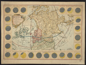 | 1748 | Solar (eclipse) | in lower left margin: "Published according to Act of Parliament Jan 1, 1748 by E. Cave" | ornamental cartouche; border of 24 insets with city names, times eclipse will be visible, and a diagram of the eclipse at specific times; has lines tracking the eclipse from sunrise to sunset | MSM 1/-#0145 | ||||
| 22 | 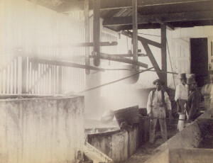 | 1889 | A variety of workers stand around pots and large vats. Presumably, based upon the title, these individuals were part of the process of changing sugar cane into sugar. Each individual wears different attire from hats to jackets. The man holding a rod is barefoot and dirtied with some type of substance. | MS0321/-#0126 | ||||||
| 23 | 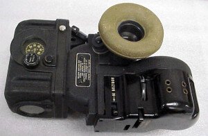 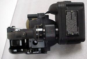 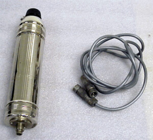 | SHORT DESCRIPTION: Bubble sextant with variable time averaging device. The index know drives the index mirror and adjusts the position of the ball relative to the disk in the averager system. An external rough scale is divided into five degree increments from -210 to 100. A drum on the index know carries a scale spanning five degrees and graduated to two arc minutes. The averager can be started and stopped in intervals over up to two minutes. Illumination is from a two dry cell battery system. In its padded plastic satchel with mounting bracket, battery case and cord. INVENTORY: battery pack, plastic case and cord - there are three (3) component parts. | CL26304 | |||||||
| 24 | 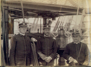 | 1889 | Pensacola (Screw steamer : 1885). | Three men that appear to be officers posing on deck in front of ship's wheel. | MS0321/-#0004 | |||||
| 25 | 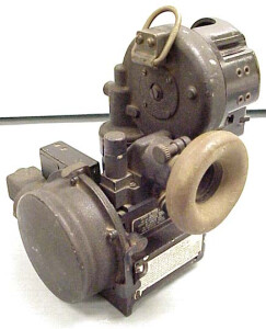 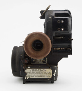 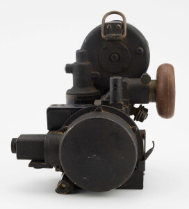 | SHORT DESCRIPTION: Manufacturer's label is missing but the octant is surely an aircraft bubble sextant AN 5851-1, Bendix Aviation Corporation, Eclipse-Pioneer Division, Teterboro, New Jersey. Pioneer Type 3014-1-A, Serial AF 42-____. No box. Nothing unusual except that the bubble is still formed. See 1998.39.37 | CL28774 | |||||||
| 26 | 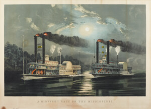 | NOTES: The print shows the steamboats NATCHEZ of the Vicksburg, Natchez and New Orleans Mail Line and the ECLIPSE used as an advertisement. "...In 1860, she (NATCHEZ) raced with the ECLIPSE. Her speed record is mention by Mark Twain in his book 'Life on the Mississippi'. 'A Midnight Race on the Mississippi' was a favorite Currier & Ives lithograph of 1860. Steamboat racing was common on all rivers then, and the public immensely interested in the outcome of the frequent 'brushes' between rivals." NOTE: Artist's actual name was Frances Flora Bond Palmer, originally from Leicester, England. | CL17933 | |||||||
| 27 | No image URL. | Ordered BAMM 9/30 | LB85699 | |||||||
| 28 | 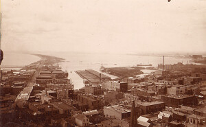  | USA; MINNESOTA; DULUTH | town | CURATOR NOTES: Bird's eye view looking over Duluth, Minnesota. Signs on building include, "T.B. Hawkes & Company, Wholesale Produce, Flour, Hay, Grain"., "J.B. Stupthin & Co. Codl Storage". SAMUEL STANTON COLLECTION. | MS0094/-#180 | |||||
| 29 | 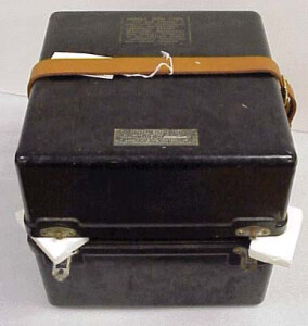 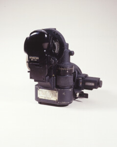 | SHORT DESCRIPTION: Aircraft bubble sextant AN-5851-1, Pioneer Type 3014-1-A, Serial AF 42-5572. The optical system is based on four reflecting prisms with associated lenses. An external knob rotates the index prism and drives an index over a rough scale divided from -10 to 100 in units of 5°. The knob has a cylindrical scale divided from 0 to 5 in increments of 2 arc seconds. The artifical horizon, with adjustable siz bubble, can be moved into the optical path to use the artifical horizon or out of the optical path to view the natural horizon. A chronometric averaging device averages about 60 sights over a two minute period. A 3 volt, two dry cell battery lighting system illuminates the counter reading and stop watch. In a foam lined metal case. See Peter Ifland, Taking the Stars. (Newport News, 1998) pp.172 185. INVENTORY: box - there is one (1) component part. | CL26212 | |||||||
| 30 | 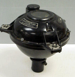 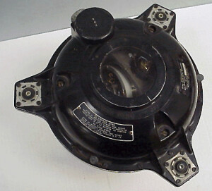 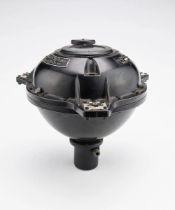 | NOTES: The gyro flux gate compass, remotely located in the wing or tail of the airplane, converts the earth's magnetic forces into electrical impulses to produce precise directional readings that can be duplicated on instruments at all desired points in the airplane. Unlike the magnetic needle, it will not go off its reading in a dive, overshoot in a turn, hang in rough weather, or go haywire in polar regions. David Coffeen doesn't know much about this instrument but thinks its terribly innovative, but is not sure whether it was a successful innovation or an innovative failure. | CL26273 | |||||||
| 31 | 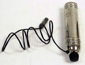 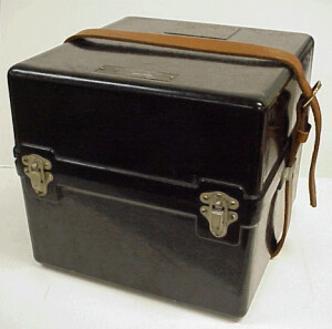 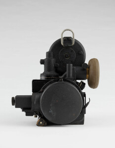 | SHORT DESCRIPTION: Aircraft bubble sextant AN 5851-1, Pioneer Type 3014-1-A, Serial AF 42-6905. The optical system is based on four reflecting prisms with associated lenses. An external knob rotates the index prism and drives an index over a rough scale divided from -10 to 100 in unites of 5°. The knob has a cylindrical scale divided from 0 to 5 in increments of 2 arc seconds. The artifical horizon, with adjustable size bubble, can be moved into the optical path to use the artificial horizon or out of the optical path to view the natural horizon. A chronometric averaging device averages about 60 sights over a two minute period. a 3 volt, two dry cell battery lighting system illuminates the counter reading and stop watch. In its foam lined metal case. INVENTORY: Case and battery - there are two (2) component parts. | CL26227 | |||||||
| 32 | 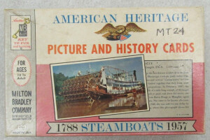 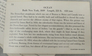 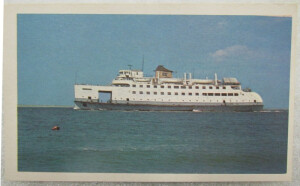 | SHORT DESCRIPTION: Boxed Set of 40 cards. Each card has a color illustration or photo of a steamboat on one side and a detailed history of the pictured item on the other. Part of a series published in 1961 that included sets of cards with Trains, Automobiles and Airplanes. Included in the cards are images of paintings and prints from the Mariners' Museum collection. Steamboats represented include: NANTUCKET, DONGAN HILLS, DELTA QUEEN, GREATER DETROIT, ALEXANDER HAMILTON, AVALON, RICHELIEU, NORTH AMERICAN, CITY OF RICHMOND, COMMONWEALTH, ASSINBOIA, YALE, TICONDEROGA, SPRAGUE, CHRISTOPHER COLUMBUS, CONNECTICUT, T. J. POTTER, J. M. WHITE, OKEEHUMKEE, ROBERT E. LEE AND NATCHEZ, ST. JOHN, SULTANA, MARY POWELL, WESTERN WORLD, ECLIPSE, WILSON G. HUNT, OCEAN, CALIFORNIA, ROBERT F. STOCKTON, MILWAUKIE, NORWICH, LEXINGTON, BEAVER, GEORGE WASHINGTON, SAVANNAH, NEW ORLEANS, ONTARIO, PHOENIX, NORTH RIVER STEAM BOAT (CLERMONT), THE STEAMBOAT. NOTES: The Milton Bradley Company was established in 1860 in Springfield Massachusetts. Bradley was originally a lithographer and became interested in the German Kindergarten movement that had been brought to the United States by immigrants. He started producing educational toys in the 1860s. Bradley introduced his Checkered Game of Life in the 1860s and also created pocket sized checker and chess games for soldiers during the Civil War. Milton Bradley has produced building blocks, art sets, lithographed sheets that could be folded into buildings, three dimension toys and popular games like the Wheel of Life. The Company is still a major manufacturer of educational toys. | CL14738 | |||||||
| 33 | 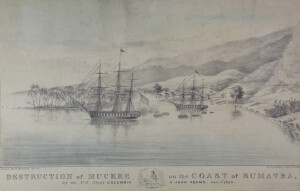 | NOTES: Meukek is a district in South Aceh Regency in Aceh, Northern Sumatra, Indonesia. NOTES: Excerpts from Warhistory.org about this event: The second East India Squadron consisting of the new frigate USS Columbia and the sloop of war John Adams, under commodore George C. Read, left the United States from Norfolk, Virginia on May 6, 1838. Having made the usual visits to Rio de Janeiro, Muscat, and Bombay, the two warships were at Colombo, Ceylon, when Commodore Read heard that Sumatrans had recently killed or wounded several seamen on board the American merchantman Eclipse, from which they had stolen a large sum in Spanish dollars and several chests of opium. Departing hurriedly on 2 December, the squadron made an eighteen-day passage to the west coast of Sumatra where inquiries revealed that those principally responsible belonged to the town of Mukkee, while others who had been involved resided at Quallah Battoo and Soo Soo. When the squadron arrived at Quallah Battoo, the village rajah promised to bring the malfeasants on board within two days. He failed to do so, whereupon the Columbia and the John Adams came to anchor close inshore with springs on their cables. Bringing their broadsides to bear, they celebrated Christmas Day with a thirty-eight-minute bombardment of the forts. After returning the fire with three ineffectual shots, the forts showed the white flag. Read thought it unwise to send a landing party to complete their destruction; but he kept his ships at their anchorage until 29 December lest Quallah Battoo gain an erroneous impression of the efficacy of its defense. Mukkee was next. The frigate sent an officer to require that the guilty individuals from there be delivered to him within two days, but his efforts were in vain. Indeed, the attitude of the rajahs led Read to believe that they would resist forcibly. On the morning of 1 January 1839, the two vessels were towed and warped into position just off the town, whence they opened a deliberate fire while a landing force prepared to disembark. The John Adams’s Commander Thomas W. Wyman led 320 sailors and marines from both companies to the beach where they formed up for an assault on the forts. Covered by the ships’ fire, they moved forward, only to find the forts and town alike deserted. All were put to the torch, and then the landing force was reembarked. Soo Soo remained to be punished, but Commodore Read found its people so inoffensive and its fortifications so pathetically weak that he merely exacted a promise that American ships and seamen in the vicinity would be protected. While the Columbia was watering ship there, rajahs from other ports came on board to assure the commodore of their friendship and their desire that the pepper trade should continue. Obviously the destruction of Mukkee had made an impression. | CL8411 | |||||||
| 34 | 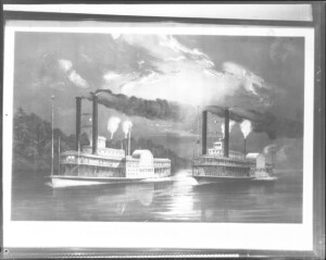 | 1883-1931 | Natchez and Eclipse, Mid-night Race on Mississippi. | Steamboats–United States. | Copy negative of an illustration showing two steamers engaged in a race. | MS0091/03.02-02#2094 | ||||
| 35 | 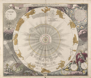 | circa 1720 | Printed in the title block: "á Ioanne Bapt. Homanno Noriberge" | Map image is a large sphere showing the solar system according to the Copernican hypothesis within a starburst; surrounding this are the signs of the zodiac in color. Outside the central image are several illustrations, some of which show putti handling navigational instruments and a representation of Urania, the goddess of astronomy. In the bottom left corner is a map of the world seen from the perspective of the North Pole. It also shows in graphic form the total solar eclipse of May 12, 1706. The rest of area outside of the central image is filled with illustrations and and text. Likely published between 1707 - 1716, published in a number of different atlases. Not 2nd or 3rd state, pre 1742. | MSM 1/-#0179 | |||||
| 36 | 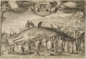 | SHORT DESCRIPTION: Black and white engraving showing a beached sperm whale by Jan Saenredam titled 'Illustri generoso Ernesto Comiti de Nassau. fortissimo Horoi, et Belgicæ Libertatis vindici acersimo D.[omino] suo clementissimo hoc monstrum [Greek word] monstro so ho faculo D.[at] D.[onat] D.[edicat] J. Saenredam'. Rough translation: To the illustrious, noble Ernest Casimir of Nassau, a very brave hero and most zealous defender of Belgian liberty, to his own most clement master, [Saenredam, the artist] gives and devotes this newly imprinted monster for this war-torn age. The scene Saenredam presents actually occurred on January 13, 1601 after a sperm whale washed ashore in the vicinity of the towns of Beverwijk and Wijk aan Zee. Ernst Casimir, Count of Nassau-Dietz and hero of the war against Spain, appears at the bottom center with a plumed hat with his back to us and armed with a handkerchief to protect himself from the dead whale's intense odor (he apparently visited the scene two weeks after the whale became stranded). Casimir is accompanied by an entourage who are recorded in fine detail. People are inspecting and measuring the carcass and the blow hole and townsfolk stream down to the shoreline from surrounding hills and a large crowd gathers to revel in the momentous occasion. In the foreground, men stride to work carrying whale axes on poles. The artist himself appears in the scene, just below the whale's jaw, where he draws the spectacle behind a cloak windbreak, using a barrel for support. The upper third of the print shows a series of slightly obscure vignettes in which Saenredam alludes to other events that are thought to be attributable to the whale's appearance on the coast. Beached whales were regarded as significant phenomena and were seen as bad omens and associated with disasters and tragedies. In the far background we have both solar and lunar eclipses which occurred shortly after the whale's appearance and, like comets and other irregularly occurring natural phenomena, were seen by contemporary observers as harbingers of doom. An unhappy face has been caricatured onto the moon(s). A rather ominous looking father time is at the upper left and a winged angel blowing a trumpet and carrying a bow is at the upper right. In the cartouche below the lion, the cartographic wind symbol can be seen blowing the land away (under the city are wheels) in reference to an earthquake that occurred at the beginning of 1602. Images include details of parts of the whale after it burst apart under the pressure of decomposing gases, the head with open jaw seen at left. There are eight stanzas of Latin verse in the lower margin. Authored by Theodor Schrevelius or Dirk Schrevel. The name on our engraving is partially rubbed out making it difficult to determine exactly what it says. NOTES: This may be a first edition. [From Whaling Prints in the Francis B. Lothrop Collection, by Elizabeth Ingalls, Peabody Museum of Salem, Salem, Massachusetts, 1987, pg 192] "The precise rendering of the sperm whale and all its anatomical details attest to the artist's having drawn from life. Should there be any question of this, the artist has actually included himself in the scene in the process of drawing the event. Eight Latin verses beneath the print, signed (Theodoor) Screvelius, describe the stranding and the disasters it presages. The rich matrix of portentous iconography above the scene includes an earthquake, solar and lunar eclipses, and Father Time with the sand running out, all further reinforcing the message that strandings are signs of God's anger and warnings of impending disaster." NOTES: Nantucket native William F. Macy learned the printer’s trade at Nantucket’s newspaper, ‘The Inquirer and Mirror.’ After going to the mainland he worked in several printing shops around Boston and was appointed as the first instructor in printing at the Lyman School for Boys in Westboro, Massachusetts. Later Macy opened an insurance agency in Boston. Throughout this time he continued studying Nantucket history and frequently contributed articles to ‘The Inquirer and Mirror’ (signing his articles "Yorick"). Around 1912, in collaboration with Anna Gardner Fish and Roland Bunker Hussey, Macy issued the first edition of the "Nantucket Scrap Basket". He arranged for a second edition of this publication in 1932. In 1915, Mr. Macy prepared and published "The Story of Old Nantucket," a condensed history of Nantucket (reprinted in 1931). He was a founder and one time president of "The Sons and Daughters of Nantucket." In 1924, Macy was appointed President of the Nantucket Historical Association and served until his death in 1935. During this time Edward F. Sanderson approached the Association about receiving his collection of whaling paraphernalia with the purpose of establishing a whaling museum on Nantucket. When he returned to Nantucket in 1928 Mr. Macy purchased the old American House property, on the corner of Orange Street and Martins Lane, and built the house now standing there. This became Macy’s headquarters during his decade of planning, raising money and finally establishing the Nantucket Whaling Museum which opened its doors on July 24, 1930. | CL10724 | |||||||
| 37 | 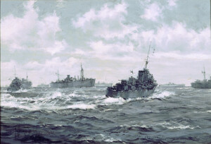 | SHORT DESCRIPTION: Monochrome painting titled 'In the Mediterranean the scene is changed' by British war artist Montague Dawson. Painted 1944. The image shows two British destroyers, one at the left and another to the right of center. In the background are many large merchant vessels in convoy. NOTES: This painting was illustrated in the October 28, 1944 issue of The Sphere on pages 112-113. The text supporting the illustration states: In the Mediterranean the scene is changed : the White Ensign and Red Duster now fly undisturbed in waters which were once highly dangerous for allied warships and merchantmen. Vessels which range from large liners down to small coastal ships now ply from point to point as required, under light naval escorts, in the manner depicted in this drawing. The destroyer on the left is one of the Isis class: that in the right foreground is of the Lookout class. Drawing by Montague Dawson. The image supports an article titled 'The Freedom of the Seas, The Eclipse of the German Navy Opens the Mediterranean and the Channel to the Warships and Merchantment of the Allies.' The text of that article reads: When Italy went out of the war last year the Mediterranean was thrown open, once again, to the Navies of the Allies : with the freeing of the Channel ports and the wiping-out of the U-boat lairs in France, the waters round the south and east coast began to enjoy a similar immunity. Except where the Japanese Fleet still operates in the Pacific, and where stray German submarines infest the Northern Atlantic, the seas are again clear for Allied warships and for Allied convoys. Writing from Cairo recently, a correspondent declared of the Mediterranean that "this whole sea looks ours; and destroyers playing like dolphins seem to be glorying in avenging the harried and stricken destroyers of other years." With the memory of 1941 still in mind, he wrote, "it seems surprising we can cruise in these seas so nonchalantly, with apparently no thought of the enemy in cloud or wave." This transformation has, of course, been brought about by the elimination of the Italian Fleet, by the suppression of the German U-boat bases in France and Italy and by the German withdrawals from the Eastern Mediterranean. The picture by Mr. Dawson reproduced above typifies the new-found freedom now enjoyed by the British Navy and Merchant Navy in those waters. The Isis class consists of vessels of 1,370 tons, most of which were laid down in 1936 and completed in 1937 and 1938. They carry a complement of 145, and are armed with four 4.7-in. guns. Each costs just over £320,000 to build. The Lookout class are newer than the Isis: they are vessels of 1,920 tons, carrying six 4.7-in. guns. The speed of both classes is 36 knots. NOTES: This was one of eleven paintings in accession 1975.03 that appeared in an exhibition put together by the Christopher Wade Gallery of 28 Bruton Street, London in 1969. The exhibition was opened by the Admiral of the Fleet, Earl Mountbatten of Burma. The title of the exhibition was ‘The Royal Navy at War 1939-1945, An exhibition of Sea Paintings by Montague Dawson, R.S.M.A., F.R.S.A.’ There is a catalog for this exhibition in the Museum’s artist file. The text supporing this painting reads: The Freedom of the Seas. In the Mediterranean the scene changed the White Ensign and the Red Duster now flew undisturbed in waters which were once highly dangerous for Allied warships and merchantmen. Vessels ranging from large liners down to small coastal ships could now ply from point to point under light naval escorts, in the manner depicted in this work. The destroyer on the left is one of the "Isis" class, that in the right foreground is of the "Lookout" class. The "Isis" class consisted of vessels of 1,370 tons, carrying a complement of 145 and armed with four 4.7 inch guns. Those of the "Lookout" class were 1,920 tons and carried six 4.7 inch guns. | CL11310 | |||||||
| 38 | 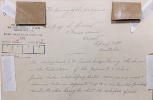 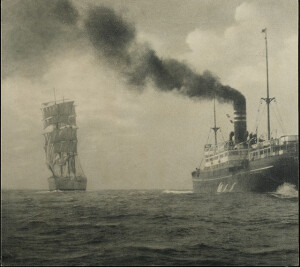 | 1932 | on verso: stamped- Exhibition of Marine Photography 1955. Photographer's stamp: Geoffrey S. Currey 13 Princess Avenue Concord, Sydney NSW Australia. Written: "The sailing vessel is the Finnish barque 'Penang' the steamer is the 'Kiliano Mare' of the Japanese N.Y.K. line. Picture taken outside of Sydney Heads. 1932, sailing vessel and steamer taken on separate days and a combination picture made, the idea being to show the eclipse of sail." | A combination photograph made from two separate events. The steamer the Kiliano Mare is seen right, in open water. The Finnish sailing vessel the Penang is seen right, left, in open water. | P0025/08-#07 | |||||
| 39 | 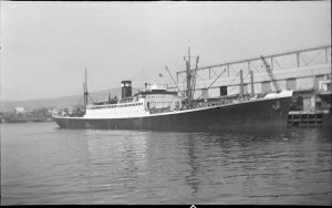 | 1883-1931 | City of San Francisco (Steamship : 1938). | City of San Francisco 1919; Ex "Eclipse", "City of Hamburg", USAT "William P. Biddle" (AP-15) | Starboard side of the steamer City of San Francisco at port. | MS0091/03.01-13#124 | ||||
| 40 | 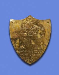 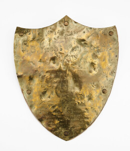 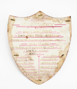 | NOTES: Brass plaque, in shape of a shield which had been attached to a mast from the yacht "America". This object was given to the donor by Mr. Charles Heft about 1937. Mr. Heft died at Sailor's Snug Harbor 1947. He was related by marriage to George Steers. | CL12112 | |||||||
| 41 | No image URL. | NOTES: Print depicts the two-hour engagement with pirates off the coast of Nigeria after which the pirates withdrew. | CL27486 | |||||||
| 42 |  | Earth (Planet)–Figure–Measurement. | Arc measures.; Weights and measures, Ancient.; Mathematics, Greek. | Circumference : __eratosthenes and the ancient quest to measure the globe __Nicholas Nicastro | LB107273 | |||||
| 43 | No image URL. | Research in maritime history ; no. 2 | Shipping–History.; Shipbuilding–History. Great Britain | Festchrift in honour of Professor Peter Neville Davies. Includes bibliography of Peter Neville Davies. | LB34957 | |||||
| 44 |  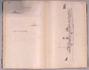 | NOTES: See object file for a detailed remarks and condition report of the individual book pages and illustrations. The book also includes an illustrated copy of the poem "The Ancient Mariner". NOTES: This sketchbook of Samuel Ward Stanton includes the following sketches and descriptions of vessels: p. 7 A.B. VALENTINE p. 8 ANGLER & AMERICA p. 9 ALABAMA & ALIDA p. 10 ALBANY p. 11 ALBANY, A.C. NICKERSON, AMERICA, ALFRED & EDWIN p. 12 ANSONIA, ARCHIE CORSMAN, ALERT, ARROW, ATLAS p. 13 AMOS C. BARSTOW, ANN JANE, LAUGLIN, A.C. CHENEY, ANNIE LAURIE & ALBERTINA p. 14 ALICE, ADMIRAL, A.R. GRAY, ALBERTA M., ALICE E. CREW, ASTORIA & ACADIA p. 15 ALBANY, ACTIVE, ADMIRAL, FARRAGUT, ATHLETE, A.J. HOOLE p. 16 ACCOMAC, AMERICAN EAGLE, ARMITABE BREARLY, ATLANTA 7 ALICE HEGARTY p. 17 AMERICA, AROMA MILLS, ARTISAN & ARIOSA p. 18 ANNEX, A.C. ROSE, ANNIE & MAGGIE, ANNA J. KIPP, AMBOY & A.C. SUMNER p. 19 AUSTIN, ATLANTIC, AMELIA, ANNEX Z p. 20 ANNA, ALICA A. WASHBURN p. 21 ADELAIDE, ABBIE, AMITE p. 22 ANNEX 3, ASSISTANCE, ATRATO & ARIES p. 23 AMERICA, AERONAUT, ALASKA, ARIZONA p. 24 BAY RIDGE, BRILLIANT & BAY RIDGE p. 25 BALTIMORE, BAY STATE p. 26 BATTLER, BURLINGTON, BOY, BORDER CITY, B.W. MORSE p. 27 BAY QUEEN AKA GENL. SEDGWICK p. 28 BELLE, BROOKLYN, BLUE STONE COMPANY & BALTIC p. 29 BRIDGEPORT, BEN, BLANCHE PAIGE & BRANDON p. 30 BELLEVUE & BALTIMORE p. 31 BLACK BIRD, BUFFALO, BLUE BONNET, BORDENTOWN p. 34 BEE, BELLE HORTON p. 35 BAYONNE, BS CRONIN, BLOCK ISLAND, BLUE STONE p. 36 BELT, BERGEN POINT, BELLE & HATTIE p. 37 CASTLETON, CYCLOPS, CEMENT ROCK, CORNELIUS VAN COTT' p. 38 CHESTER A. ARTHUR, CLIMAX, CITY OF YONKERS, CORNELIA p. 39 CITY OF TROY p. 40 CITY OF BRIDGETON, COLDEN, COL. E. B. GRUBB, C.H. STARBUCK, C.A. DICKEY p. 41 CANONIEUS, CHAUCEY M. DEPEW, CRYSTAL STREAM, C.L. MARCHAL p. 42 CONNECTICUT, CHAS. H. SENIFF p. 43 C. VANDERBILT p. 44 CHRYSTENAH, COMMONWEALTH, CLARA, CHAS. A. SILLIMAN p. 45 CETUS, COM. DURYEA, CYRENE p. 46 CHARLOTTE, VANDERBILT, CLARA, CHIEF, CLINTON p. 47 CITY POINT, COLORADO, CHARLES RUNYON p. 48 CITY OF LAWRENCE, CITY OF WORCESTER P. 49 CHAUNCEY VIBBARD, COMMUNIPAW, CITY OF MONTICELLO p. 50 CITY OF SPRINGFIELD, CHARLES C. COUTANT p. 51 CRYSTAL WAVE, CHAS. E. SOPER, CAROLINE A. PEENE, CHICAGO p. 52 CITY OF RICHMOND p. 53 CITY OF RINGSTON, COE F. YOUNG AND CHRISTIANA p. 54 CITY OF SPRINGFIELD p. 55 CAYUGA, CITY OF NORWALK, CAPTAIN JOHNM, CHAS ALLEN p. 56 COLUMBIA p. 57 CEPHEUS, CITY OF ALBANY p. 58 CONTINENTAL p. 59 CITY OF NORWICH, C.W. STANDART, CITY OF BRIDGEPORT p. 60 CHANCELLOR p. 61 CITY OF LONG BRANCH, CORA L. STAPLES, COM. BARNEY p. 62 CITY OF HUDSON, CLAR, C.F. ROE, CLAVIN TOMKINS p. 63 CHAMPION, CLARA, CATSKILL p. 64 CHARLES R. STONE, CHARLES F. STARIN p. 65 CITY OF CLEVELAND p. 66 COMMUMPAW, CAPE CHARLES p. 67 CITY OF BOSTON, CITY OF NEW YORK p. 68 CAMELIA, CERES, CONQUEROR p. 69 CITY OF FALL RIVER, CHAS. B. SANDORD p. 70 COMMODORE PERRY, CITY OF BROCTON p. 71 CYGNUS, CRESCENT CITY p. 73 C.H. NORTHAM p. 75 COLUMBIA p. 76 CADET, CLARION p. 77 CITY OF DETROIT p. 78 COMMONWEALTH p. 81 D.S. MILLLER, DEFIANCE, DOUGLAS, DIAMOND p. 82 DAKOTA, DELAWARE (Built 1883, South Amboy, New Jersey, Belonged to Pennsylvania Rail Road) p. 83 AUGUSTA, AGAWAM, ARIEL COOLEY, ATLANTA, ADVOCATE, ARROW, AMERICAN EAGLE, ALBANY p. 84 ARABIAN, AUGUSTA, AMITY, ALGONQUIN, ARIEL, AVALANCHE, ASIA, ALBANY, ALABAMA, AMBOY, AUGUSTA, ANSON p.107 STR. PERSEUS p.109 MARTHA WASHINGTON p.112 STR. CONNECTICUT p.116 STR. NEW YORK p.166 MUTUAL p.177 VIVA, E.T. DUBLOIS, IDA L. TEBO p.203 BLACK BIRD p.213-216 Poem "The Monitor" published in Harper's Weekly, May 9, 1863 with pen/ink sketch of MONITOR sinking. p.219 YOSEMITE p.223 SCANDINAVIAN p.239 L.A. BELKNAP p.267 CONNECTICUT, MAINE, CITY OF W p.269 LYNN p.271 E.P. PICKETT p.277 FRED B. Dalzell p.279 WM F. BURDEN, ECLIPSE, CONTINENTAL, OLLIE p.280 PEGUOT | CL23609 | |||||||
| 45 | 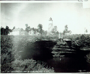 | 1893/08/16 | WISCONSIN | CURATOR NOTES: View of keeper retrieving water from quarry. From link: Devils Island is the northernmost island on the western edge of the Apostles Group, and represented an important turning point for both east and westbound vessels coasting along Superior's southern shore. With the opening of the first lock at Retrievuing Ste Marie in 1855, maritime traffic along Superior's south shore increased dramatically, and while Eagle Harbor Light had been established 123 miles to the east to guide vessels around the Keweenaw in 1851, and Minnesota Point was lighted to mark the entrance into the twin ports of Duluth/Superior 72 miles to the west in 1858, this important navigational landmark remained unlighted for more than thirty years. The Lighthouse Board took up the call of mariners, requesting an appropriation of $15,000 for the establishment of a station at Devils Island in 1888, and while Congress enacted legislation for the establishment of the station, they neglected to follow-up with the requested appropriation, and without the necessary funding, work on the station could not begin. After the Board reiterated the request for funding in its 1889 annual report, Congress responded with the requested funds on March 2 of that same year, and the Eleventh District Engineer dispatched a survey crew to the island to select a site and to begin the process of obtaining clear title. While awaiting for matter of title to be decided in the Wisconsin courts in 1890, Eleventh District Engineer Major William Ludlow determined that the planned station would benefit greatly from the incorporation of a steam-powered fog signal, and without having included the cost of such a system in the original proposal, recommended that an additional $5,000 be appropriated for the new station. Congress quickly approved the additional money on March 2, bringing the total amount of the Devils Island appropriation to $20,000. The importance placed on this new station was evidenced by the fact that the plans called-out that it be outfitted with a flashing Third Order lens, an order reserved for only the most critical aids to navigation on the Great Lakes. In fact, at that time only six Third Order stations were in operation in the entire Eleventh District, with four of them on Lake Superior at Whitefish Point, Au Sable Point, Manitou and Outer Island, another of the 22 islands making up the Apostle Group. However, after receiving a number of bids for the station's construction in 1891, the Board realized that it had significantly underestimated the costs associated with such a remote and inaccessible construction site. Estimating that the total cost for the station was going to end up closer to $42,000, the Board beseeched Congress to appropriate an additional $22,000 to begin construction. With no progress in reaching an agreement on the purchase of the island from the current owner, proceedings were initiated to acquire the property through condemnation. Realizing that it was highly unlikely that Congress would be forthcoming with the increased appropriation yet that season, and understanding that the lighting of Devils Island was critical to maritime interests, work quickly began on the construction of a temporary tower structure on the north shore of the island. The temporary tower consisted of a skeleton timber-framed structure with an enclosed wood-sided watchroom. Standing 24 feet square at the base and 9 feet 6 inches square at the top, the structure stood approximately 60 feet in height. Outfitted with an octagonal cast iron lantern containing a fixed red Fourth Order Fresnel lens, the light stood at a focal plane of 87 feet by virtue of its location atop one of the island's cliffs. The Devils Island Light was exhibited for the first time on the evening of September 30, 1891, its light visible at a distance of 13 miles across the surface of the lake. Work began on the island in earnest at the opening of navigation in 1892, with the construction of a 1½-story wood-framed outbuilding which would serve as temporary quarters for the construction crew as they worked through the summer, and by October the station was virtually complete. A steam-powered hoisting derrick was constructed to the west of the site to allow supplies to be hoisted up the cliff and a cellar was blasted in the rock with a 1½-story brick keepers dwelling constructed atop this foundation. A 100 foot-long trench was blasted in the rock to allow the connection of a sewage disposal pipe leading from the station's cellar directly to the lake, and a landing crib and boat house were constructed at the shore. A pump house and covered water delivery pipe were built to the fog-signal building located 500 feet to the northwest of the tower. The fog-signal building itself was a wood frame structure with the exterior sheathed in corrugated iron and the interior surfaces sheathed with smooth iron sheets. The walls were packed with a mixture of sawdust and lime to help fireproof the structure, and the duplicate 10-inch steam whistles and boilers were then installed within. The steam whistle controller was adjusted to ensure that the signal conformed to the predetermined 60-second repeated characteristic, consisting of a 5-second blast followed by a 10-second silence, 5-second blast and final 40-second silence. However, without an appropriation for the necessary funds for the permanent tower and second keeper's dwelling, work on Devils Island was stopped at the end of the 1892 season of navigation. The Lighthouse Board repeated its request for the funds for completing the station in each of its annual reports for the following three years, with Congress finally authorizing the work on February 15, 1895, and following-up with an appropriation for the necessary funds on March 2. However, the wording of the appropriation specifically called-out that the appropriation was to be spent on the construction of the permanent tower, and while the total amount of the appropriation was sufficient to complete the station, without written approval to build the keepers dwelling, construction of the dwelling was out of the question. Congress amended the appropriation on June 11, 1896, allocating $4,000 of the remaining funds for the construction of the keepers dwelling. Condemnation proceedings were finally brought to a close in August, with an award of $1,600 being paid to the former owner of the island. With the funding sorted-out, Eleventh District Engineer Major Milton B. Adams advertised bids for the metal work of the cast iron tower and placed the order for the Third Order Fresnel lens with Parisian lens manufacturer Henry-Lepaute. A working party arrived on the island on July 1, 1897 and work began on the second dwelling, which was built as a duplicate of the first structure, and laid concrete foundation for the new tower. The structural iron work of the tower was delivered to the Detroit Depot in June of 1898, and after a successful inspection, was loaded on the tender Amaranth along with a working party and dispatched to Lake Superior. Arriving at Devils Island, the work crew extended the boat landing, repaired the boat house and steam powered derrick, and began erecting the 80 foot tall iron tower on the foundation laid the previous year. Work on the tower was completed on October 17th. Consisting of a central cylinder topped by a circular watch room, the entire structure was reinforced by four iron buttresses, reinforced with iron lattice work at the flared lower end at which point they were bolted into the concrete foundation. The watchroom was outfitted with circular portholes and surmounted by a gallery on which was centered a circular cast iron lantern with diagonal astragals. Standing 81 feet from the foundation to the ventilator ball, the entire structure was given a coat of white paint, with the exception of the lantern and roof, which were painted black to help differentiate them from cloudy skies, thereby increasing the towers' effectiveness as a daymark. Since the new lens had not yet been received from Paris, the decision was made to keep the fourth order lens in the old timber tower active until receipt of the new illuminating apparatus. After numerous delays in Paris, the Third Order lens and pedestal were finally delivered to the Detroit depot in 1901, and the lens, District Lampist, a work party and the materials needed for station repairs were loaded aboard the Amaranth, and delivered to Devils Island on June 22. While the Lampist carefully removed the pedestal and lens segments from their wooded crates and hoisted them up to the lantern for assembly, the work party built approximately 1,000 feet of tramway connecting the various station buildings, cleared brush and timber to ensure that the new light would be visible from all directions, constructed a woodshed and installed an improved derrick. Work at the island continued until September 20, when the brilliant new Third Order lens was exhibited from the new tower for the first time. This new lens represented a remarkable improvement over the old fourth order lens displayed from the timber tower. Equipped with bulls eyes, the lens rotated about the lamp once every 20 seconds to emit a white flash of 1.3 seconds duration followed by an eclipse of 8.7 seconds, a red flash of 1.3 seconds and an eclipse of 8.7 seconds. No longer serving any purpose, the timber skeletal tower and lantern were dismantled in 1904, and the materials placed in storage. 1907 saw the extension of the boat landing and the construction of a 78-foot long rubble stone sea wall to protect the shore in the area of the boat house. The keepers settled into the daily routine for the next 14 years, with no major events of changes at the station. In 1914, the station's illuminating apparatus was upgraded from kerosene fuel to a more efficient oil vapor system with an increase in output of the white flash to 45,000 candlepower and the red flash to 35,000 candlepower, and a resulting increase in the range of visibility to 18 miles. Also in 1914, in order to correct a stability problem similar to that previously encountered at the Sturgeon Bay Ship Canal Light, the new tower was retrofitted with four vertical columns connected by horizontal bracing, which provided additional bracing to the watch room, and helped increase the tower's structural rigidity. As part of a network of stations being installed around the Great Lakes, Devils Island was outfitted with a radiobeacon system in 1925, with the system placed into operation on October 30. A transmitter was installed in one of the station buildings and connected to an antenna located 220 feet from the tower. The station transmitted at a frequency of 286 kilocycles and transmitted repeated groups of three Morse Code dashes every 60 seconds followed by 60 seconds of silence during periods of thick weather. Additionally, the transmitter was activated every morning and evening for a half hour test between 5.00 and 5.30 and 11.00 and 11.30. The following year saw the removal of the 10-inch steam whistle from the fog signal building and the installation of a much improved air-operated diaphone fog signal. The station was equipped with a diesel-powered electrical generator in 1928, with a resulting increase in the intensity of the light to 300,000 candlepower for the white flash and 180,000 candlepower for the red flash. Also at this time, the flash characteristic was changed to a white flash of 0.6 seconds followed by an eclipse of 9.4 seconds, red flash of 0.6 seconds and a final eclipse of 9.4 seconds. Since the stations in the Apostles chain closed down every December, the generator was winterized before the keeper's departed and thus the light was simultaneously extinguished. However there was always the possibility that a few straggling vessels would be making their way through the thickening ice without the benefit of the Devils island light as a guide. To serve these late season vessels, that same year the lantern was equipped with a 200 mm, 130 candlepower acetylene-powered winter light. With a large tank of acetylene located close to the base of the tower, the gas was piped into the lantern and automatically turned on and off every day by means of a sun valve, which used a bimetal mechanism which expanded and contracted in reaction to the difference in day and nighttime temperatures, automatically switching the flow of gas to the lamp. With the Coast Guard's assumption of responsibility for the nation's aids to navigation in 1939, five-man coast guard crews were assigned to the island to tend the equipment. After President Nixon signed legislation creating the Apostle Islands National Lakeshore on September 26, 1970, most of the islands in the chain were incorporated into the National Park System. However, the Coast Guard continued to maintained ownership of the lighthouse reservations. As the other Apostles lighthouses were automated and their crews removed through the 1970's, a crew still manned the Devils Island Light station, using it as a base of operations to maintain and repair the other lights in the island chain. Thus. in 1978 the Devils Island Light became the last of the Apostle Lights to be automated through the installation of a 12-volt solar-bulb within the Fresnel lens. In 1986, Congress passed legislation transferring all lands within the Apostle Islands National Lakeshore Park boundaries over to the NPS, and in a single stroke of the pen all of the Coast Guard properties within the park were moved to NPS ownership, and while the Coast Guard still maintained the right to service the aids to navigation within the park, the NPS took ownership of all of the former Lighthouse reservations and the structures therein. In order to protect the station's Third Order lens from further deterioration or vandalism, the Coast Guard disassembled the lens and removed both it and the cast iron pedestal from the lantern in 1989, replacing it with a solar-powered acrylic 190 mm optic mounted on the gallery hand rail. The lens was shipped to storage at the NPS headquarters in Bayfield. In 1992, the Apostle Islands National Park determined that it would be fitting to restore the lens and return it for permanent display in the lantern atop the tower on Devils Island. Greg Byrne, an NPS conservator from Harpers Ferry, West Virginia was contacted, and Greg arrived in Bayfield that summer to restore the massive lens. The lens was carefully returned to its crates, and on August 31, was loaded on a National Guard Chinook helicopter and flown back to Devils Island, where NPS employees erected a hoist on the tower gallery and with a tractor on the ground providing the pulling power, carefully lifted the 600-pound components of the pedestal onto the gallery and back into the lantern. With the pedestal reassembled in place, the following day the lens sections were carefully hoisted to the lantern and reassembled on the pedestal. While the Vega VRB-25 optic mounted on the gallery railing still serves as the light source for the station, the Fresnel lens sits majestically in the lantern designed to hold it, a befitting location for such a wonderful object. Visitors fortunate enough to make landing on the island can climb the tower stairs and enter the lantern to marvel at the jewel-like intricacy of the century-old French lens. Finding this Light While all of the Apostle Island Lights are open for visitation, a private boat is needed to make landfall at Devil's Island for all but two weeks of the year. While Apostle Island Cruise Service offers daily trips around the islands, passing close to the island for photography, it is only during the two weeks of the annual Keeper of The Light festival in September that they offer landings on Devils Island. Contact information P.O. Box 691 - City Dock Bayfield, WI 54814 Telephone: (800) 323-7619 Email: info@apostleisland.com For information on the Keeper Of The Light Celebration, contact: PO Box 990 19 Front St. Bayfield, WI 54814 Telephone: (800) 779-4487 Historical references Annual reports of the lighthouse Board, various, 1853 - 1909 Annual reports of the Lighthouse Service, various, 1910 - 1953 Great Lakes Light Lists, various, 1861 - 1977 Annual reports of the Lake Carrier's Association, various, 1906 - 1940 Wisconsin Maritime History Association, website Recent photograph courtesy of Dan Tomhave, and Ken & Barb Wardius. Historic photographs courtesy of the USCG and NPS historians offices. Email correspondence with Bob Mackreth NPS, various, January & February 2002 Wisconsin Handbook, Thomas Huhti, Moon Travel Handbooks, 1997 Keeper listings for this light appear courtesy of Great Lakes Lighthouse Research | P0001.012/01-#PL196 | |||||
| 46 | 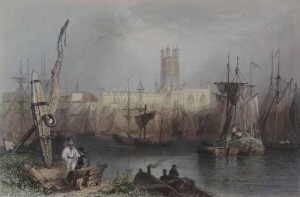 | SHORT DESCRIPTION: The image depicts the harbor of Gloucester in England. In the background is the Gloucester Cathedral and other buildings. In the foreground numerous ships are docked in the River Severn, one with a large cargo and several men aboard. In the left foreground there are several men standing on the banks of the river talking near a large anchor and a cart. Another man sits in a small boat with his back to the viewer, possibly smoking. NOTES: The image is from before page 89 of volume 2 of “The Ports, Harbours, Watering-Places, and Coast Scenery of Great Britain," published by George Virtue in 1842. (TMMP Library DA625 .F49 Rare) The book was first published in 1838 by Charles Tilt with descriptions by William Andrew Chatto. It was then published several times in 1839 and 1842 by George Virtue, and later after 1855 by Virtue & Co. under George’s son, James S. Virtue. The name also changed slightly, but kept the "Ports, Harbours, and Watering Places" part of the title. The books that the Virtues published kept Chatto’s descriptions for the first volume, but they expanded the book to two volumes. William Beattie wrote the text for the new second volume and an appendix added to the end of the volume 1. NOTES: From the end of the 1842 edition of Volume 2: “In taking leave of these two Volumes, illustrating the Ports, Harbours, Watering-places, and Coast Scenery of Great Britain, a few words of explanation appear necessary. The work was originally commenced by Messrs. Finden [William and Edward], and for some time carried on with all the taste and spirit characteristic of these distinguished Artists. But the remuneration accruing from the sale being found inadequate to defray the expenses incurred in its production, it was offered to the present Publisher, who readily saw the improvements of which it was susceptible and became the purchaser. Arrangements were then made for its continuation. Mr. BARTLETT, whose illustrations are so familiarly and favourably known to the Public, set out on a tour of observation along the northern coasts of England and Scotland; and, after visiting every locality indicated, returned with a portfolio of drawings taken on the spot. These were immediately placed in the hands of eminent engravers; a re-issue and continuation of the work were announced; and it is gratifying to state, that the reception which it has since met with from the Public has been most liberal. With regard to the letterpress descriptions, I beg it to be expressly understood that the labours of my pen have been confined to the Second Volume and the Appendix of Vol. 1. The First Volume was written under the signature W.A.C. - prior to my connexion with the work; and, in justice to that author, I feel it at once a duty and a pleasure to conclude the work with this statement. William Beattie, M.D.” January 1842 J. Rickerby, printer, Sherbourn Lane NOTES: Construction of the Gloucester Cathedral began in 1089 and it was consecrated as St. Peter’s Abbey in 1100. As with most buildings this age it has changed over time. The abbey was dissolved in 1540, but just a year later King Henry VIII designated it as the cathedral for the Diocese of Gloucester. Excerpt: “Caer-Glow, or the “Fair City” of the ancient Britons, is a name happily characteristic of Gloucester. The beauty of its situation, on a gentle eminence overlooking the Severn, where its splendid cathedral and numerous public buildings; and latterly the tide of prosperity occasioned by the vast improvements in regard to its inland part, present a combination of attractions for which it would be difficult to find a parallel in the British Provinces. Commercial enterprise has now a fixed residence in the place, and within the last ten years has made great and important advances in the several departments of foreign and domestic industry. The port of Gloucester and the Cathedral, of which the accompanying plate gives a most correct and interesting view, are the two principle features; and to these in accordance with the plan of the work, our descriptive text will be more strictly confined. The port is of great antiquity,- so much so as to have existed as an inland harbour long prior to any written document of the place,- but it is only of late years that ships of burden could be anchored in the city basin. A century ago, as recorded in the Magna Britannia, the Port of Gloucester had a large quay and wharf on the banks of the river, very commodious for trade to which belonged a great custom house, with officers proper for it; but the business was not great, as the city of Bristol, only a few miles distant, had engrossed all the foreign trade in this part of the country. The vessels which at the period in question navigated the Severn were generally small trading-craft, of between fifty and two hundred tons burden, so that Gloucester was deprived of all those advantages which have been so happily secured to it by modern enterprise and improvement. Of these, the Berkley ship-canal is a noble monument. By the vast facilities thus afforded, the commerce of Gloucester has enjoyed a course of uninterrupted prosperity and bids fair to eclipse even Bristol itself in the extent and ramifications of its still increasing trade. Ships of heavy burden are now safely moored in the basin and discharge those cargoes in the heart of the city which had formerly to be transshipped to Bristol, and conveyed to their destination by means of barges and lighter.” | CL16421 | |||||||
| 47 | 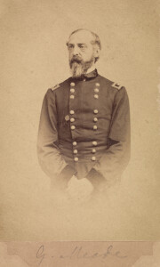 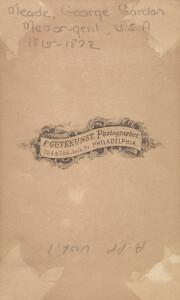 | Circa 1865 | Written on verso: Meade, George Gordon, Major-genl., U.S.A., 1815-1872, photographer stamp on verso:F. Gutekunst, Photographer, 704 & 706 Arch St. Philadelphia | Vignette, standing portrait, in uniform. The victor of Gettysburg, George G. Meade does not rank with the great captains of the Civil War in part because of his eclipse in the last year of the conflict by the presence of Grant with his army, and a journalistic conspiracy of silence. Born of American parents in Cadiz, Spain, December 31, 1815-where his father had run into financial and legal difficulties as a result of the Napoleonic Wars-he was appointed to West Point from Pennsylvania. Graduating in 1835, he served a year in the artillery before resigning to become a civil engineer. After some difficulty in finding employment he reentered the army in 1842 and earned a brevet in Mexico. His Civil War assignments included: captain, Topographical Engineers (since May 19, 1856); brigadier general, USV (August 31, 1861); commanding 2nd Brigade, McCall's Division, Army of the Potomac (October 3, 1861 - March 13, 1862); commanding 2nd Brigade, 2nd Division, 1st Corps, Army of the Potomac (March 13 - April 4, 1862); commanding 2nd Brigade, 2nd Division, Department of the Rappahannock (April 4 - June 12, 1862); commanding 2nd Brigade, 3rd Division, 5th Corps, Army of the Potomac June 18-30, 1862); major, Topographical Engineers June 18, 1862); commanding lst Brigade, 3rd Division, 3rd Corps, Army of Virginia (August 26 - September 12, 1862); commanding 3rd Division, lst Corps, Army of the Potomac (September 12-17 and September 29-December 25, 1862); commanding the corps (September 17-29, 1862); major general, USV (November 29, 1862); commanding 5th Corps, Army of the Potomac (December 25, 1862 - January 26, 1863 and February 5-16 and February 28-june 28, 1863); commanding Center Grand Division, Army of the Potomac January 1863); commanding Army of the Potomac June 28, 1863 - December 30, 1864 and January 11 - June 27, 1865); brigadier general, USA July 3, 1863); and major general, USA (August 18, 1864). Serving on a survey of the Great Lakes at the outbreak of the Civil War, he received a volunteer brigadier's star in the first summer of the war and was assigned to the division of Pennsylvania Reserves. After training and service near Washington and in northern Virginia, the command joined the Army of the Potomac on the Peninsula. During the Seven Days he fought at Beaver Dam Creek and Gaines' Mill before falling wounded at Glendale. He led his brigade at 2nd Bull Run, following his recovery, and the division at South Mountain and Antietam. At the latter he succeeded the wounded Hooker in command of the lst Corps and received his second star before Fredericksburg. In that action his division broke through the Confederate right but was thrown back after his supports failed to arrive. Transferred to the direction of the 5th Corps, he briefly commanded the Center Grand Division after the Mud March until that cumbersome organization was disbanded. At Chancellorsville he led his corps well but was held back by Hooker's timidity. Wiith the invasion of Pennsylvania, Meade was chosen to relieve Hooker in army command only three days before Gettysburg. Originally planning to fight farther to the rear along Pipe Creek, he dispatched General Winfield S. Hancock to Gettysburg-following the death of General John F. Reynolds-to determine if it would be an acceptable battlefield. Accepting that officer's opinion, he ordered a continued concentration there. During the next two days he masterfully shifted his troops from one threatened sector to another. He received the, thanks of Congress and an appointment as a brigadier in the regulars. However, he soon came in for criticism for allowing Lee to escape to Virginia without another battle. His handling of the Bristoe and Mine Run campaigns was not shining. In the spring of 1864 newly appointed General-in-Chief U.S. Grant set up his headquarters with Meade's army. This cumbersome arrangement worked out surprisingly well. However, since Meade was known for his temper and had come into conflict with a number of correspondents, there was an agreement not to mention him in dispatches except in reference to setbacks. He fought through the Overland and Petersburg campaigns, earning Grant's respect and being considered for command in the Shenandoah. At Grant's request he was advanced to major general in the regular army. He served in the Appomattox Campaign but felt slighted by the reports which seemed to give all the credit to Grant and Sheridan. Mustered out of the volunteer service, he continued in the regular army, performing Reconstruction duty in the South. In 1866, he became commissioner of Fairmount Park in Philadelphia, a post he held until his death. He died in Philadelphia November 6, 1872 as a result of old war wounds complicated by pneumonia. Source: "Who Was Who In The Civil War" by Stewart Sifakis and "Historical Times Encyclopedia of the Civil War" Edited by Patricia L. Faust. | P0001.016/02-APP01#024 | |||||
| 48 | 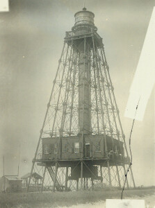 | USA; FLORIDA | Description: Those responsible for the Sand Key Lighthouse must have skipped out on their Sunday School classes, for they definitely missed the valuable lesson taught in the Sermon on the Mount that it was a “foolish man, which built his house upon the sand: And the rain descended, and the floods came, and the winds blew, and beat upon that house, and it fell: and great was the fall of it.” This lesson was demonstrated over and over again on Sand Key, as three dwellings, one lighthouse, and numerous wharfs, privies, and outbuildings were lost to the power of wind and water. Sand Key is situated next to a channel that leads to Key West, located roughly eight miles to the northwest. In normal conditions, a significant amount of sand accumulates on the submerged reefs at Sand Key, creating a small island. Soon after the United States took possession of Florida, a wooden daymark was placed on the island to warn mariners of this nearly hidden threat to navigation. Lighthouses to mark Florida’s reefs had just recently been completed at Cape Florida, Key West, and the Dry Tortugas, when Congress allocated $16,000 on May 18, 1826 for a lighthouse on Sand Key. The plans for this tower, similar to those used on the other three, called for a 70-foot, conical brick tower exhibiting the light from eleven lamps set in 14-inch reflectors. Sand Key’s light, however, revolved, producing a flashing signature that differentiated it from the nearby fixed light at Key West. The first keeper of the Sand Key Lighthouse was slated to be Joseph Ximenez. However, Keeper John Flaherty and his wife Rebecca were having a terrible time adjusting to their isolated life in the Dry Tortugas, so the collector of customs at Key West, William Pinkney, arranged for the two keepers to trade assignments. Shortly after the Flahertys arrived on the island, the Sand Key Light was exhibited for the first time on April 15th, 1827. With fishermen, wreckers, and picnickers from Key West frequenting the island, the Flahertys thoroughly enjoyed their new social life. Their joy, however, was short-lived as John fell ill in May of 1828 and passed away in 1830. Rebecca remained on the island and was appointed keeper after her husband’s death. In June of 1831, William Randolph Hackley, an attorney in Key West, recorded the following account of a visit he made to the Sand Key Lighthouse: “The wind was so light that we did not get to the key until 12…I went up to the lighthouse. The light is revolving and is one of the best in the United States. It is kept by Mrs. Flaherty…She, with her sister and a hired man, are the only inhabitants of the key and sometimes there are none but the two females…The length of the key is from 150 to 200 yards and the average breadth 50 … [We] remained till evening and, having spent a pleasant day, returned to town at 8:00 P.M.” The November 22, 1834 edition of The Florida Herald reported on a wedding at the Sand Key Lighthouse; Rebecca Flaherty had married a Captain Fredrick Neill. The newlyweds took a lengthy trip the next year to visit family, while a temporary keeper watched the light. Upon their return, Captain Neill was appointed keeper, serving until his resignation on February 10, 1836. Captain Francis Waltington was the next keeper, maintaining the light until July 27, 1837, when the colorful Captain Joshua Appleby succeeded him. Born in Rhode Island in 1773, Appleby became a widower at a young age, when his first wife, Sarah Viall, died at 23, leaving him alone to care for their year-old daughter, Eliza. In 1820, Appleby sailed for the Florida Keys, where he co-founded a settlement on Vaca Key and made a living from the sea through fishing, turtling, and salvaging shipwrecks. Appleby’s salvaging practices were soon called into question as he was accused of conspiring with privateer Charles Hopner to intentionally run aground vessels captured by Hopner so the cargo could be salvaged and sold. Commander David Porter, head of the naval squadron at Key West responsible for eradicating piracy, had Appleby arrested in 1823 and taken in irons to Charleston, South Carolina. Appleby must have been innocent or had friends in high places as he was later released after Smith Thompson, Secretary of the Navy, and President James Monroe reviewed his case. Upon securing his freedom, Appleby returned to Rhode Island for a time, and then relocated to Key West by 1830. The government granted Appleby a license as a wrecker, a trade that he practiced for several years. Then, on July 27, 1837 he accepted an appointment as head keeper of the Sand Key Lighthouse. While Appleby’s livelihood had previously depended on ships misfortunes, it was now his duty to help keep ships safely away from the reefs. During Appleby’s tenure at the lighthouse, hurricanes struck Sand Key in 1841 and 1842, with the latter destroying the keeper’s dwelling and seriously damaging the lantern. In 1843, a seawall was built around the lighthouse property to provide protection from the storm surge that accompanied the hurricanes. The following year, the wall was put to the test, and it failed. The new keeper’s dwelling was swept away along with a good portion of the island. Appleby’s daughter, Eliza, visited the lighthouse in October 1846, along with her husband, their three-year-old son, Mary Ann Petty Harris (a friend from Newport, Rhode Island), and Mary’s adopted daughter. On October 11, a hurricane, described as “the most destructive of any that has ever visited these latitudes in the memory of man,” hit Sand Key. As the hurricane strengthened, Appleby and his five visitors very likely sought refuge in the lighthouse, since the tower had withstood previous storms. The seawall again proved no match for the hurricane, as the raging sea swept across the island washing away the dwelling, the tower, and the island itself. The following morning waves were observed rolling over the reef where the island had been, and no trace of the lighthouse could be seen. Still, the reef posed a threat to vessels, and the Honey, a 140-ton ship, was soon purchased in New York, recommissioned as a lightship, and sent to Florida to mark Sand Key. Congress acted quickly as well, allocating $20,000 on March 3, 1847 for a new Sand Key Lighthouse and then adding an additional sum of $39,970.74 to the project in 1848. Before the new lighthouse was completed, at least eight vessels had run aground on the reef, resulting in a loss of over $425,000. Although lighthouses were expensive to construct, the reduction in lost cargo easily offset the investment. Around 1850, control of U.S. lighthouses was passing from the Fifth Auditor of the Treasury, Stephen Pleasonton, to a Lighthouse Board. This change in leadership most likely delayed work on the new lighthouse. As one of their first acts, the newly formed board chose a screw-pile design by Isaiah W.P. Lewis for Sand Key. John F. Riley Ironworks in Charleston fabricated the body of the tower, while J.V. Merrick and Son made the lantern room. Lewis sailed to the Keys with the material and work crew, and then oversaw the placement of the seventeen foundation pilings. The piles were arranged in a 4x4 grid around a central pile, and each of them was bored into the coral seabed to a depth of ten feet below the surface of the water. At this point, construction stopped due to lack of funds. Additional funds, approved in September 1852, were finally made available in December, and George Meade, who had completed the Carysfort Reef Lighthouse in March of 1852, was transferred to Sand Key to assemble the lighthouse. Work began anew on January 22, 1853. Meade described the lighthouse as a “pyramidal framework … divided into six [horizontal] sections, the piles at both ends fitting into cast-iron sockets at the juncture of each section, and being united together by a uniform system of horizontal tension and diagonal braces. The dimensions of the piles, sockets, and braces of each section diminish proportionately to its elevation.” Within the second horizontal section above the water, a square dwelling, consisting of nine, twelve-foot-square rooms, was constructed. One of the rooms held a five thousand gallon tank for holding rainwater collected from the roof and a thousand gallon tank for oil. From the dwelling’s center room, a spiral staircase with 112 steps led up a cylindrical tube to the lantern room. Over 450 tons of iron were used in constructing the lighthouse, which stood 132-feet tall and cost $126,000. A first-order Fresnel lens, Florida’s first, was placed in the lantern room and lit for the first time on July 20, 1853. The lens produced a unique characteristic consisting of the repeated cycle of a fixed white light for one minute, a partial eclipse of twenty-five seconds, a white flash of ten seconds, and finally another partial eclipse of twenty-five seconds. Meade added a couple of personal touches to the lighthouse. It was here, that his hydraulic lamp made its debut. Meade’s lamp required less maintenance and was soon adopted for general use by the Lighthouse Board. Meade also used diagonal astragals in the lantern room, a distinguishing feature he applied to all of his Florida lighthouses. The new lighthouse hadn’t been standing long when it too was exposed to the full force of a hurricane. Hurricanes struck the tower in 1856 and 1865, followed by the “Twin Hurricanes” of 1870, and another one in 1874. Each hurricane swept away most of the island, and the station’s wharf, boathouse, privy, and oil house were destroyed multiple times. By 1875, the dwelling perched in the tower had suffered so much abuse at the hands of the hurricanes that it too had to be replaced. As the bolts used to hold the dwelling together were thoroughly rusted, much cutting was required to remove the old structure before it could be replaced with a new, heavier one. During the periods between hurricanes, when sand built back up around the lighthouse, thousands of terns congregated on Sand Key to nest. Tern eggs were found to be quite tasty, and the lighthouse keepers would collect them by the basketful to deliver to their friends on Key West. Keeper Charles G. Johnson, stationed at the lighthouse in 1902, reported to William Dutcher, chairman of the American Ornithological Unit, that “nine to twelve thousand birds used to nest on Sand Key, but so many eggs were taken only two to three hundred young ones hatched.” On neighboring islands, birds were being killed by plume hunters seeking fancy feathers to adorn ladies hats. Alarmed by the decimation of the bird population, Dutcher formed a Bird Protection Committee, and hired bird wardens to patrol the islands. Keeper Johnson signed up as a warden, and made Sand Key a safe haven for the terns by running off anyone attempting to disturb the nests. In 1941, not long after the lighthouse came under the control of the Coast Guard, the light was automated and the dwelling vacated. The Fresnel lens remained in the tower until 1982, when it was removed and replaced by a modern beacon. Major renovation of the Sand Key Lighthouse was undertaken in 1989. Workmen were in the process of replacing corroded parts, and sandblasting and painting the structure, when during the evening of Sunday, November 12th, Coast Guard Key West received a report that the historic lighthouse was ablaze. One would think that the iron structure would be immune to fire, but the contractor’s flammable paints and the dwelling’s wooden furnishings provided ample fuel for a fire. Much of the damage was limited to the core of the lighthouse, where the intense heat caused the spiral staircase and its cylindrical covering to collapse. A study, complete with computer modeling, was funded to determine if the damaged structure could be saved. Based on the results, the Coast Guard decided to spare the lighthouse, and a $500,000 restoration project started in 1994. Even though the lighthouse was on the National Register of Historic Places, the decision was made to remove the damaged dwelling and central column, as restoring the lighthouse to its former state proved too costly. A light was absent from the tower from 1989 to 1998, when a solar-powered VRB-25 aerobeacon was placed atop the lighthouse. Today, the iron structure still stands sentinel over the dangerous reef, but no evidence of human habitation remains on the island. The nearby waters are often dotted with snorkeling tourists from Key West, who are likely oblivious that on this tiny, transient patch of ground keepers lived for over a hundred years, giving their time and even their lives to provide safe passage through these dangerous waters. References Lighthouses of the Florida Keys, Love Dean, 1998. | P0001.012/01-#PL084 |
Created 2026 by Don Barker, CBMM volunteer, for the Chesapeake Shipbuilding Project. shipbuilding@sailingworkboats.es